'https://www.googletagmanager.com/gtm.js?id='+i+dl;f.parentNode.insertBefore(j,f); Rectangles

May 6, 2011

Road Trip: A Few Things Seen In Black And White

Plant lump in the sand dunes.

Stick, sand and shadow in the dunes.

Dark hills and evening sky in the Panamint Range.

Green hills and blue sky in black and white.

Boulders, hills, mountains and low clouds.

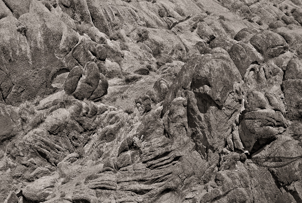
Lumpy rocks.

Twisty, crawly, lumpy rocks.

Boulders.

Just plain creepy.

Tufa and sky.

Tufa, plant and sky.

May 5, 2011

Road Trip: Day 7, 10:30 AM to 1:00 PM

Goose Lake Map

Goose Lake on the California/Oregon border. 

Picnic table, Summer Lake last picture of the road trip. Six, or so, more hours of driving and we're home. 

May 4, 2011

Road Trip: Day 6, 1:00 PM to 7:00 PM

Mono Lake

Top of a tall tufa tower.

Calcium rich springs bubble up into carbonate rich waters forming limestone around the springs.

Over the years the deposits build into towers and cities of towers.

In 1941 the city of Los Angeles began diverting the streams that fed the lake.

Over time the level of the lake dropped over 40 vertical feet. Sarah is in the lower right hand side.

Exposing tufa towers. That plant like thing is a plant. 

The Mono Lake Committee was formed in 1978, negotiations were held, agreements were made to raise the lake to a marginally healthy reasonable level.

Mono Lake, view from the driver's seat. That's the Peanut Butter Fairy below the rear view mirror.

Sierraville Post Office.

Restroom and bath at the Sierraville Country Store just down the street from the Post Office.
On to Alturas. 

In Alturas, view of the back of the Four Corners Market.

May 3, 2011

Road Trip: Day 5, 11:30 AM to 5:30 PM

How The West Was Won, High Sierra, Gunga Din, Charge of The Light Brigade, Lives of a Bengal Lancer, Tremors, and many old cowboy movies were filmed in this area, the Alabama Hills in Owens Valley CA. 

I think Mt. Whitney is in the clouds somewhere.

More rocks, recognize any of them from old Roy Rogers, Gene Autry or Hopalong Cassidy shows? Me either.

Geologic phantasmagoria. 

After many days of nature a picture of Lone Pine and two gas stations at a stop at Carl's Jr for gas and lunch .
Looking up Owen's Valley from the dirt road side (east).

Searching for the picture above.


 And taking it. 

Inside the museum in Manzanar an original door.

View of Owen's Valley and the Sierras from the Manzanar Museum men's room.

Manzanar parking lot looking east.

Looking SW.

Entrance to Manzanar from U.S. 395 looking west to the Sierras.

Lenticular clouds over the Inyo Mountains looking east from Manzanar.

An excavated garden with water feature at Manzanar. Water would flow from the hill of rocks down to the ocean pond just behind the fence. As you drove around the site there were several gardens designed like this.

May 2, 2011

Road Trip: Day Four, 6:00 PM to 7:30 PM

Old hills in the Panamint Range.

View across Death Valley due east from Mahogany Flats at sunset.

View at sunset, southeast to the end of Death Valley. Mahogany Flats elevation 8,133' is at the end of a long, steep, snowy, rutted, single lane dirt road. From here there is a 7 (?) mile trail to the top of Telescope Peak, 11,049'. By this time it was 7 PM we didn't go.

Charcoal kilns on the way down from Mahogany Flats. The charcoal was transported and used to smelt ore.

They were allegedly designed by a Swiss engineer, built by Chinese laborers and refurbished by Navajo stone masons about 90 years later. They were only used for a couple of years then the ore ran out.

If you race down the west side of a large mountain you can see lots of things at sunset. Glorious light on these things. Sarah said the acoustics were great inside them.

May 1, 2011

Road Trip: Day 4, 3 PM to 5 PM

Plant pile in sand dunes near Stove Pipe Wells.

Woman in the Dunes.

Stove Pipe Wells Fire Department.

Mosaic Canyon, a narrow canyon of polished marble.

Woman in the canyon.

Polished marble and trail.

Sometimes you run into a bottle neck in the canyon and pictures of people taking pictures must be taken. Note Sarah anchoring the lower right corner.

Looking up the narrow trail further up the canyon.

Looks like a breccia, a conglomerate, a transitional breccia-conglomerate and a falt line.